
History of Jaraguá, Goiás
Jaraguá was born in the 18th-century gold rush, grew with the Belém-Brasília highway and is now known throughout Brazil as the clothing capital.
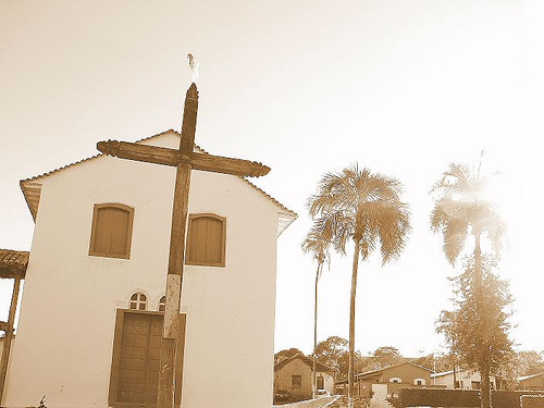
Gold and the first settlers
The exact date when settlement began in Jaraguá is not known. It certainly came after the founding of the Arraial de Meia Ponte (1727, today Pirenópolis) and of Santa Rita do Anta (1729), when outsiders entered the region and began mining gold illegally. After punishing them, the authorities found that the region did in fact hold great promise for mining, which triggered a huge influx of adventurers of every kind. Nearby lived the Jaguará indigenous people, from whom the municipality takes its name.
Father Silvestre and the founding of the town
With the arrival of the legitimate owners of the mining claims and the exploitation of slave labor, the settlement grew considerably. In 1833 Father Silvestre Álvares da Silva and his assistant, Father Manoel Ribeiro de Freitas, arrived in Jaraguá and helped lay the first foundations of local progress. The settlement took the name Nossa Senhora da Penha de Jaraguá and was raised to the status of a town (vila) by Decree No. 8 of July 1, 1833, separating from Meia Ponte. It became a city under Provincial Law No. 666 of July 29, 1882, adopting the name Jaraguá. It is the seat of a judicial district (comarca).
The House of Father Silvestre, on Vigário Álvares street, is protected as state heritage (Decree No. 6,024, of 2004) and today houses the municipal House of Culture.
From stagnation to the Belém-Brasília highway
When the gold ran out, the town stagnated for a long time. The construction of the Colônia Agrícola road, between 1941 and 1944, rekindled growth: agriculture gained a route to the main markets of the state and the country.
The big turning point came with the Belém-Brasília highway (BR-153). Trade developed as never before, and new subdivisions and neighborhoods appeared, such as Vila Isaura, Vila Coroado, Vila Colombo, Vila Brasilinha, Vila Rio Vermelho (BNH), Jardim Ana Edith, Jardim Aeroporto and Jardim Atlântico. Jaraguá became an essential trading post between northern and southern Goiás.
Geography and villages
Jaraguá lies in the Mato Grosso de Goiás zone, at an elevation of 610 meters, with a humid tropical climate and temperatures between 17 °C and 33 °C (63 °F and 91 °F). It covers 1,848.947 km², according to IBGE. The main river is the Rio das Almas, which runs the full length of the town and receives tributaries such as the Rio do Peixe, the Pari and the Sucuri. The most important elevation is the Serra de Jaraguá, home to the television towers.
The municipality includes the villages of Alvelândia, Artulândia (along the GO-5 highway), Cruzeirinho, Mirilândia, Monte Castelo, Palestina, Santa Bárbara, Vila Aparecida (Jatobá) and São Geraldo. Read more on the Geography of Jaraguá page.
Economy: from pineapples to jeans
Farming focuses on corn, beans and pineapple, along with beef and dairy cattle. But it was the clothing industry that transformed the town from the last decades of the 20th century onward: today there are hundreds of factories, most of them in the Setor Aeroporto district and on Avenida JK, and Jaraguá jeans are sold wholesale to retailers from many parts of Brazil. Discover the clothing factories of Jaraguá.
Timeline
| 18th century | Gold mining and the formation of the settlement. First chapel of the Nossa Senhora da Penha Mother Church (1748) and the Rosário Church (1776). |
|---|---|
| 1828 | Construction of the Nossa Senhora da Conceição Church begins. |
| 1833 | Father Silvestre arrives; the settlement becomes a town (July 1). |
| 1882 | Raised to city status under the name Jaraguá (July 29, now the town's anniversary). |
| 1941-1944 | The Colônia Agrícola road revives the economy. |
| 1950s-60s | The Belém-Brasília highway (BR-153) and urban expansion. |
| 1918-1950 | The Mother Church is demolished (1918) and rebuilt (1950). |
| 1998 | The Serra de Jaraguá becomes an Ecological Park (State Law No. 13,247). |
| 2015 | State Law No. 18,844 changes the name and boundaries of the area, which becomes the Serra de Jaraguá State Park. |
| 2025-2026 | The Outlet Jaraguá, on the BR-153, and the Expo Jaraguá. The State Park's Management Plan is approved in June 2026. |
| Today | A clothing and jeans hub, with 45,223 inhabitants in the 2022 Census. |
Keep exploring: culture and traditions, town festivals, old and recent photos.
Updated on September 24, 2026